Eleven Mexican Wolf Pups Journey From Captivity to Join the Wild Population
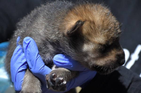
PHOENIX — Eleven genetically valuable captive-born Mexican wolf pups have been placed into wild dens to be raised in the wild by their surrogate parents after another successful fostering season. Now in its seventh year, the Mexican wolf fostering program continues to help boost the genetic diversity of this endangered subspecies.
Over a three-week period this spring, 11 pups were fostered into five wild packs across New Mexico and Arizona. The pups traveled from captive facilities across the U.S. as part of a coordinated effort to place genetically diverse wolves into the wild population in support of recovery efforts.
Fostering is a proven method used by the Mexican Wolf Interagency Field Team (IFT) to increase genetic diversity in the wild Mexican wolf population. It begins with carefully managed breeding by the Mexican Wolf Species Survival Plan (SSP) program to produce genetically diverse pups within the captive population. Within 14 days of whelping (being born), the captive-born pups are transported to the wild and mixed together with similarly aged wild pups.
Once all of the pups are placed back into the wild den, the breeding female’s maternal instinct kicks in. She will feed and care for both the wild and captive-born pups. With the help of her pack mates, the pups will be raised with the skills and knowledge needed for a life in the wild. The IFT has documented that fostered pups have the same survival rate as wild-born pups in their first year of life (about 50%). Read more