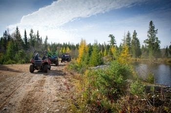
If you’re a fan of heading off the beaten path, you’re probably familiar with Michigan’s thousands of miles of state forest roads. The DNR annually updates state forest road maps on April 1. Maps are available in an interactive web format and as printable PDFs.
Forest road maps are updated each year based on considerations including changing road conditions, data cleanup and input received from residents. Maps show which state forest roads are open or closed to off-road and conventional vehicle use. It’s important to stay on these roads to prevent erosion and damage to wildlife habitat.
After the annual road inventory and review, the following will be open to ORVs:
In the Upper Peninsula, more than 5,503 miles – about 98% of the total mileage.
In the northern Lower Peninsula, about 6,109 miles – about 84% of the total mileage.
In the southern Lower Peninsula, just over 10 miles – about 3% of the total mileage.